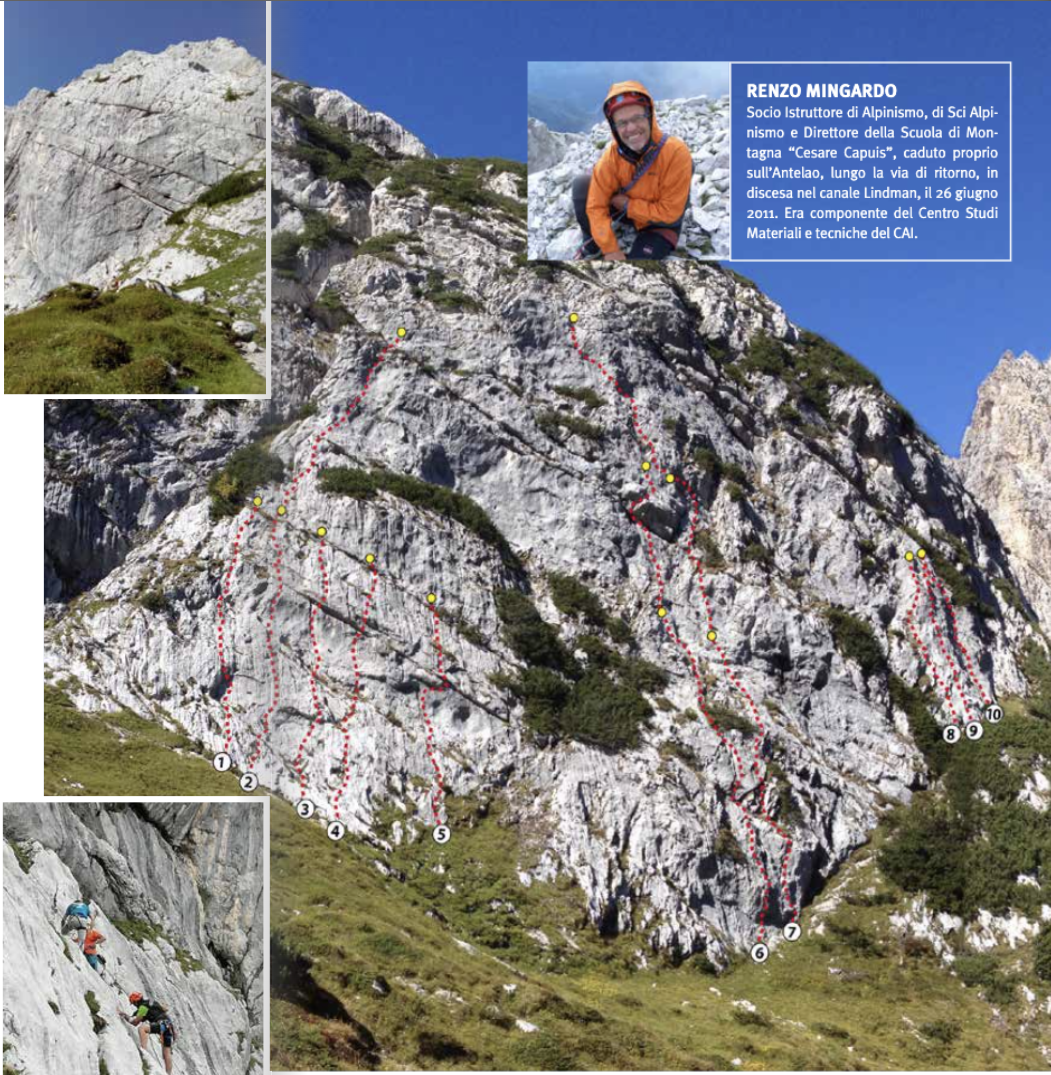
Among the opportunities related to the Center’s usage, there is the availability of a climbing cliff 10 minutes walking from the Rifugio. The equipped cliff is named after Renzo Mingardo, an instructor of mountaineering school “Cesare Capuis” who passed away on Mount Antelao in 2011. The climbing routes (around 10) were equipped for the maximum safety in climbing. The belays, rigged at 25 m, allow the usage of 50 m single ropes (55 m advised). Complexity level goes from 4th to 6th degree, making this spot suitable for the teaching of climbing and self aid maneuvers. For climbing and any kind of activity around the cliff it’s mandatory to use the helmet.
ALPINE ACTIVITIES CENTER
Rifugio Galassi offers an Alpine Activities Center on the second floor, made up of a multifunctional conference room and a gear storage room. The Center can be used by CAI groups and all those who want to organise conferences, meetings, courses or lessons. Projection gear and mountain related didactic material is provided, and the conference room can host up to 50 people sitting. Center’s users can benefit of a price agreed upon for board and accomodation. The center is named after Gianluigi Visentin and Roberto Malgarotto, both instructors from mountaineering school “Cesare Capuis”, deceased in 1992 because of an avalanche in Himalaya.
ALPINE PATH OF THE DOLOMITES N.5 (TIZIANO'S)
This path goes from Sesto (1317 m) in Val Pusteria (BZ) to Pieve di Cadore (800 m, BL), around 100 km in length and quite irregular and unique in nature. Named after Renaissance painter Tiziano Vecellio, who was born in Pieve di Cadore. The easternmost alpine path in the central Dolomites, it goes through the Marmarole range, a part of the Dolomites which is still untamed and wild due to neighboring more famous peaks “stealing the spotlight” and the length of its own routes. It merges with path n.5 in its last section after Rifugio Galassi. Before that, this path crosses Sesto Dolomites, Giralba Valley and Mount Agudo.
ALPINE PATH OF THE DOLOMITES N.4 (GROHMANN'S)
This path goes from San Candido (1173 m) in Val Pusteria (BZ) to Pieve di Cadore (880 m, BL), being approximately 90 km long. Technically challenging despite its relatively short length, this Alpine Path is renowned for its peculiar and fascinating high mountain sights. Named after Paul Grohmann, the famous Austrian explorer who did many ascensions in the very zone which now is crossed by the path. This path has many equipped sections that can be very exposed and/or challenging, and unlike other Alpine routes, there are no easier ways around those, so a certain degree of experience is required. In the final section path n.4 merges with path n.5, precisely from Rifugio Galassi until the end in Pieve di Cadore.
NATURALISTIC-GLACIOLOGIC ANTELAO PATH
This path is developed in the mountain range between Valle del Boite, Val d’Oten and Valle del Piave. The route allows for a journey in the geological past of the area: like reading a book in which each chapter is made up by the rock formations with their history of layers and fossil, the main chapter being about the Dolomia rock, from which its namesake mountain range, the Dolomites. This route is generally divided in three stages, and it takes as a starting and ending point the town of San Vito di Cadore (1100 m). The first step is Rifugio Galassi (see “How to get to us – From San Vito di Cadore”), the second is Rifugio Antelao and then back to the starting point. Naturalistical and geological facts and peculiarities are noted in the book “Il sentiero naturalistico-glaciologico dell’Antelao” by the Veneto and Friuli Venezia Giulia Science Committee.
RING ROUTE PRACIADELAN - GALASSI - PRACIADELAN
Parking the car in Praciadelan makes a beautiful ring route a possibility. After getting to Rifugio Galassi and then to the Upper Glacier fork (1920 m, see previous paragraph). Follow path 258 which descends through the green meadows of Piani di Antelao until Cason Antelao (1672 m); the trail goes on steeply down the valley and through the forest to get to the comfortable dirt road which leads to Praciadelan where the ring began (6 hours from Rifugio Galassi).
TO RIFUGIO ANTELAO (1796 m)
Follow path 250 as per Upper Glacier route, after the Glacier Saddle descend to find the last portion of Vallon Antelao (Antelao valley) until the fork of the valley itself (1920 m). Once there ignore path 258 which leads to Calalzo and Val d’Oten and instead follow the crack of Campestrin Valley and then ascend the slope which leads to Forcella Piria (2096 m). After this saddle there’s a descent just aside of the Crode di San Pietro pinnacles until Sella Pradonego, where Rifugio Antelao lies (6 hours from Rifugio Galassi).
UPPER GLACIER
To get to the second ablation zone, follow path 250 until the start of the via ferrata which ascends to Forcella del Ghiacciaio (Glacier saddle, 2545 m). It’s a medium difficulty route, equipped with steel cable which allows to climb the 200 m rock bastion between the moraine and the saddle. This route is part of the common trait between Alpine paths n.4 and n.5 which goes from Rifugio Galassi to Rifugio Antelao. Via ferrata set is required.
LOWER GLACIER
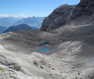
The Antelao range still holds two ice and snow ablation zones. The first one can be reached with a simple and short walk along path 250 which runs along the wide basin under the peak. Despite the obvious retreat of the ice, it is still possible to get there in any season. (1 hour from Rifugio Galassi).
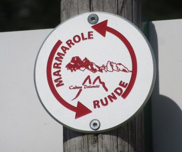
MARMAROLE RUNDE
It is a new ring-shaped route which allows in 3 to 5 days to travel the whole Marmarole range, which extends for 13 km from west to east. The trekking begins in the valley parking at the base of mount Agudo. After reaching Rifugio Monte Agudo (1573 m), a path starts which takes to the large meadows of Pian dei Buoi. From there, an old military dirt road leads to Rifugio Ciareido (1969 m) and an amazing sight on the neighbouring mountains. The trekking goes on maintaining a constant altitude, passing by Rifugio Bajon (1826 m), and then Rifugio Chiggiato (1911 m). A steep road then leads to Capanna degli Alpini (1395 m), where the path to Rifugio Galassi (2018 m) and Forcella Piccola starts. After crossing the scree slope the route goes through Rifugio San Marco (1823 m) from which is possible to reach Forcella Grande (2255 m), the highest point of the whole route. After Forcella Grande the route crosses the Natural Reserve of Somadida to get back to the State road. From the State road the starting point is reachable by bus or taxi, or walking a couple of hours along the bike track.
